Flat Rocks Wind Farm – 3 viewsOne of the many new wind farms in South West Australia, where it\'s flat and windy and there\'s sufficient demand for energy. 18 x 2.8MW turbines in this one.
|
|

Stirlings West – 4 viewsWest Stirling Ranges, Western Australia, looking towards Bluff Knoll from Toolbrunup. The only place that it regularly snows in WA. No snow today, and last week it was a record 44ºC, unprecedented in this part of the World so everything was a bit toasted.
|
|

East Stirling Ranges – 3 viewsHeading West into the Stirling Ranges, Western Australia, on Stirling Range Drive. 43km of moderate corrugations, and me without a compressor so road pressure it is! Tally ho. Lovely drive though, beautiful part of the world.Ticked over 220,000km on this trip.
|
|

Exploring South Stirlings – 3 viewsExploring the tracks around the Stirling Ranges, Western Australia. Most are closed off to prevent the spread of dieback disease, so fair enough. No inappropriate recreational activities here, just a picnic in a cocky\'s access road.
|
|

Mt Barker Antenna – 2 viewsVisited the largest free standing structure in the Southern Hemisphere, the Mt Barker Tower. Lots of Telcos and TV stations share this one. Also has the friendliest magpie colony in WA, happy to sit on the mirror and eat out of your hand :)
|
|

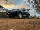
Mt Observation mugshot – 2 viewsA wee adventure off the road to York, Western Australia. Gravel mode and Yokohama Geolandars and away we go.
|
|

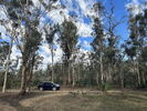
Wandoo National Park, Mt Observation – 1 viewsFound a nice spot at the bottom of the valley with grass trees and parkland type clearings. We took the hard way down from Mt Observation on the marked road with plenty of big puddles, washaways and deep ruts, but it was no trouble and handled with aplomb. Impressed with this one on the gravel and in the rough.
|
|

Controlled Burn picnic – 2 viewsTime for a cup of tea and a snack before the drive home. The black patches are burnt foliage where the local fire authority try to reduce the fuel build up and bush fires.
|
|

 Forum-Gallery-Shop-Sponsors


 Forum-Gallery-Shop-Sponsors
